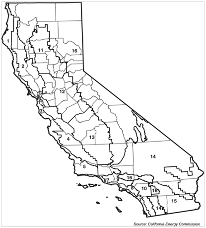
To standardize calculations and to provide a basis for presenting the prescriptive requirements, the Energy Commission has established a set of standard climate data for each of the 16 climate zones. More information is provided in Reference Joint Appendix JA2, including a listing of climate zones for all California zip codes. Reference Joint Appendix JA2 gives other climate information such as design temperatures for sizing HVAC equipment. The climate zone definitions and data are the same for both the low-rise residential and the nonresidential standards.
Beginning with the 2013 Standards, zip code boundaries are used to define climate zone boundaries; under the new rules, a given zip code is alway located entirely within a single climate zone.

Building location data refers to specific outdoor design conditions used in calculating heating and cooling loads. Different from the climate zone used for compliance (see Climate Zones above), design data includes the typically warmest and coolest outdoor temperatures that a building is likely to experience in an average year in its particular location.
Temperatures are from the ASHRAE publication, SPCDX, Climatic Data for Region X - Arizona, California, Hawaii, Nevada, May 1982 edition (see Appendix C). For heating, the outdoor design temperature is the Winter Median of Extremes. A higher temperature is permitted, but no lower than this value. For cooling, the outdoor design temperatures must be the 1.0 percent Summer Design Dry Bulb and the 1.0 percent Wet Bulb columns.
If a building location is not 'listed, the local enforcement agency may determine the location for which data is available that is closest in its design characteristics to the actual building site.